Meander
Measuring made easy.
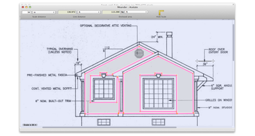
Screenshots
This app is now retired. If you have a copy it will still work on systems pre-Sonoma.
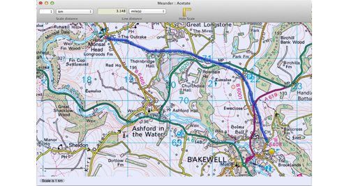
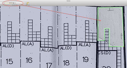
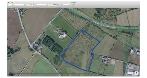
- An original way to measure routes, shapes, areas, anything that you can see on your screen
- Simply draw your line with mouse clicks on a nearly-transparent window over your map, chart or diagram
- Set Meander's scale against a known distance
- A selection of units included; miles, kilometers, metres, feet, inches, cm, mm and now acres, hectares
- Add any further units you like
- Can take account of hilliness of terrain when measuring distance or area
- Useful for engineers, architects, walkers, runners, cyclists etc etc
- OSX native, Yosemite tested and supported
Reviews
 "It's quite basic, but that actually turns out to be one of its main strengths."
- Macworld, 4 stars. http://www.macworld.co.uk/review/utilities/meander-21-review-2520/
System Requirements
Mac OSX 10.6 or higher.
History
v3.1.1
- Now free
v3.1
- Adds two built-in area units, hectare (ha) and acre (ac)
- Allows user to add additional area units, so if you wish to measure large areas in 'an area the size of Wales' you can!
- Pro tip - to add Wales as a unit, the conversion factor you need to enter is 4556.42 (the number of metres along one side of a square of this unit)
- Applies 'hilliness' slider to area as well as distance
- Values of the hilliness slider revised
- At its maximum setting, it applies an adjustment equivalent to a 66% / 32 degree slope over the entire length of the route or over the entire enclosed area
- Note that the effect of the slider is logarithmic which is appropriate
- Preferences window now stays on top of acetate window, which is more user-friendly when acetate window is used full-screen. It can be moved or closed, even while drawing a line, and of course recalled with cmd-comma
v3
Meander began as a measuring tool with a simple idea, a clear window on which you trace a line as complex as you like and then read off the distance and enclosed area.
It gained more features aimed at walkers and route planning and lost sight of its original simple concept. Eventually development stopped because of online tools which make a better job of route planning using a leisure map, such as the Ordnance Survey Getamap service.I think there's still a place for an application which can measure shapes and areas on your screen in a variety of units, and so 2014 saw version 3, a new version of Meander cut down to its transparent window and basic measuring functionality. Anyone using a previous version should continue to do so unless they are happy that the new version contains all of the functionality they need.